| 7.2. Setting the Study Area | ||
|---|---|---|
 | Chapter 7. MTA parameters |  |
| 7.2. Setting the Study Area | ||
|---|---|---|
| | Chapter 7. MTA parameters | |
The setting of the study area should be the first step of any analysis. Setting the basis of the study can be done by answering the following questions:
which spatial extension (area) and for which geographical level?
which division will be the elementary zoning?
Figure 7.1. Study area fields
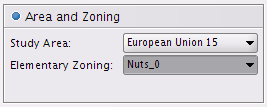
Study Area shows the spatial extension that will be mapped.
Elementary zoning shows the set of elementary units that will be studied.
Figure 7.2. Combination of study area and elementary zoning
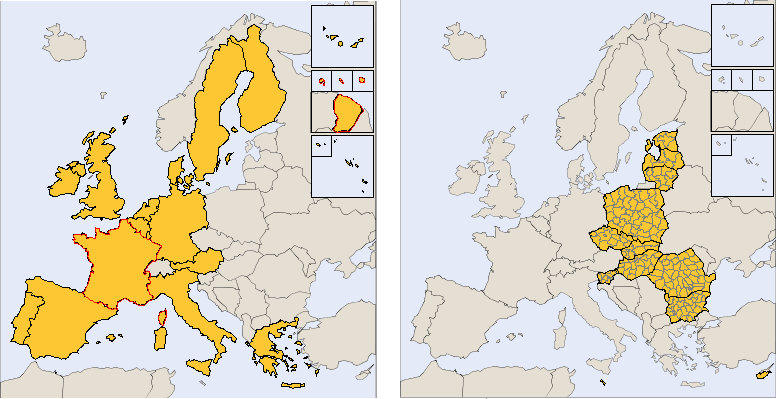
These two maps were extracted from the "Area and Zoning" tab of the application with following settings:
| Study Area | Elementary Zoning | |
|---|---|---|
| Map on the left | European Union 15 | NUTS 0 |
| Map on the right | New member states 12 | NUTS 3 |
| |  | |
| 7.1. An example of multiscalar typologies of regions |  | 7.3. Setting the indicators |